


Nicholasville, KY, U.S.
Instant Business Intelligence
Stream high resolution aerial imagery directly to your desktop or mobile device. View and measure with MapBrowser™, or integrate with leading GIS or CAD platforms.
View the e-Book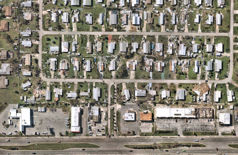
Post-catastrophe imagery and AI-derived property damage and condition data unite to help insurers process customer claims more efficiently.
Improve planning and design, while reducing your number of site visits. Frequently updated, high-resolution imagery helps increase both sales and your bottom line.