
New Imagery up to 3 times per year
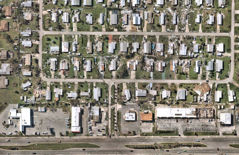
Introducing: Nearmap for Post-catastrophe Response
Post-catastrophe imagery and AI-derived property damage and condition data unite to help insurers process customer claims more efficiently.
Post-catastrophe imagery and AI-derived property damage and condition data unite to help insurers process customer claims more efficiently.
Confidently address the growing needs of your community without procuring costly individual flyovers. Our proactive survey capture program helps you understand change at scale with frequently updated, high-resolution aerial content up to 3 times per year. Within days of capture, access the latest 2D, 3D and AI content on-demand — or offline upon request — to help reduce lengthy site visits, enhance mapping capabilities, detect change over time and accurately manage your assets. Get access to post-catastrophe aerial data to reduce your community's risk with Nearmap ImpactResponse for Government.
New Imagery up to 3 times per year
Consistent 2.2-3" (5.5-7.5cm) GSD
Stream content within days of capture
Catalogs of historical imagery at your fingertips
Over 1,740 urban areas
Check out a few of our trusted government technology integration partners:


